![]()
Route4Me and Geotab Integration
Route4Me offers a complete integration with the Geotab platform to automatically import and synchronize your vehicles into your Route4Me.
How It Works
The integration can be setup in minutes and the Geotab devices are automatically imported into the Route4Me vehicle list. The data received from Geotab is automatically associated with the ID numbers of the corresponding vehicles. You can track the activity of your vehicles in real time.
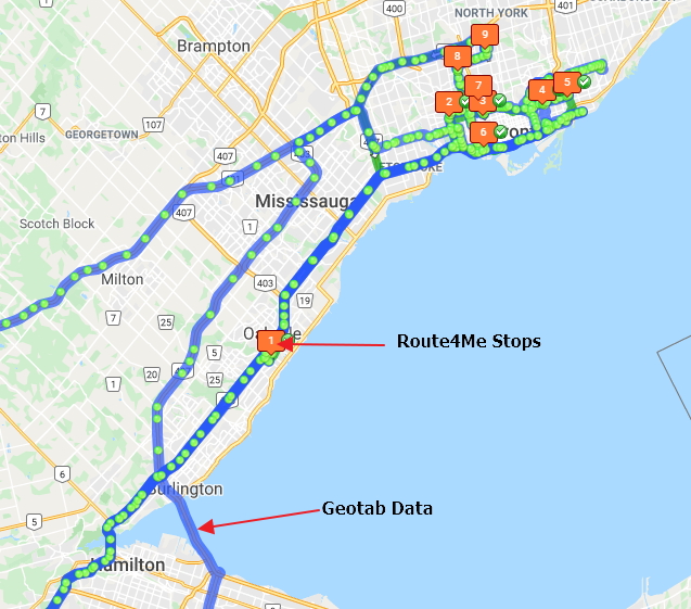
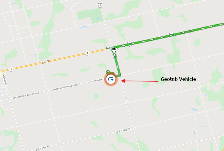
Once the data is synchronized, the Route4Me system will show the tracking data from you vehicles. When your vehicles are out in the field, their tracking data is captured by Geotab and sent to Route4Me where it is evaluated and processed. This tracking data will be shown in the Route4Me routes list where you can compare the planned vs actual route driven by the vehicle.
Route4Me will use the data from the Geotab to automatically work out when the vehicle visited the assigned stops and mark them as visited in the route progress list. Drivers can also use a smart phone and the associate app for proof of delivery and customer signatures!
Get More Insights With Route4Me Statistics
Route4Me automatically associates the data with the corresponding vehicles and provides all available real-time and historical tracking information in the form of statistics, relevant metrics, and actionable intelligence. For your convenience, vehicles’ icons can be changed to the Geotab logo to make it easier to track the vehicles in Route4me.
Why Use Route4Me?
Route4Me provides dynamic route sequencing and optimization software. Highly intuitive and easy to use, Route4Me allows customers to create, share, manage, track and drive optimized routes in a matter of seconds.
As new orders come in and older ones are completed, routes constantly change and need to be re-optimized. With Route4Me, you can now stay synchronized, ensuring that the optimal dispatch sequence is safely and automatically accessible on the Route4Me Android or iOS mobile app.
Features & Benefits*
- Multiple-Routes Mapping – Dispatchers using Route4Me can view the planned routes for all vehicles and the real-time position of all vehicles, including latitude & longitude, speed and which direction a vehicle is heading, on a map.
- Planned Route vs. Actual Driver Behavior – Business owners and dispatchers can now compare planned routes with the actual breadcrumbs for all drivers.
- Dispatching – Dispatchers can send driver’s routes directly from Route4Me to the driver’s Route4Me mobile app for voice-guided turn-by-turn directions.
- Plan optimized routes for all your drivers automatically inside of Route4Me’s website and dispatch them to your driver’s Route4Me mobile app without any legwork. This allows you to get the best route, to the right driver, at the right time.
*please note that features may vary between plans. Our experts can consult with you to help determine the appropriate plan for your business.
For more information visit the Geotab marketplace page for Route4me or their site directly here.
Please contact us for pricing information for Route4Me.
Check Pricing
All of our GPS tracking solutions are customized for your business and tailored to your budget...
Return on Investment
At GPS Tracking Canada, we understand that every company benefits from GPS Tracking in different ways...
Request a Demo
Get a live one-on-one demonstration from GPS Tracking Canada. See for yourself how customized...
For more information, or to schedule a demo or an installation,
call us toll free at 1.877.477.0987